
Recently, mammatus clouds were observed hovering over Nebraska, United States.
Mammatus Clouds
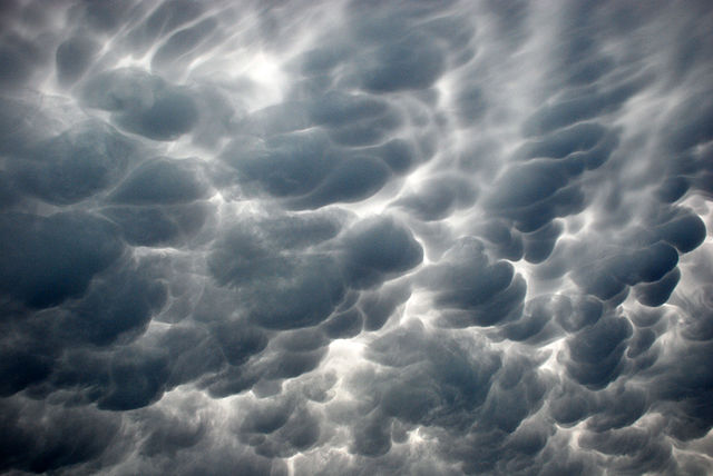
Mammatus clouds are a rare and fascinating natural phenomenon that can be seen in the aftermath of a thunderstorm or other severe weather event. These unique formations are often seen as pouch-like protrusions hanging from the undersides of cumulonimbus clouds, usually after a thunderstorm. They are known for their distinctive appearance, with a series of rounded, bubble-like shapes that resemble mammalian udders, hence their name.
Mammatus clouds are not a type of cloud, but rather a cloud formation that occurs under specific atmospheric conditions. They are typically associated with thunderstorms, but can also form in the aftermath of a tornado or other severe weather event. They are most commonly seen in the late spring and early summer in the United States, although they have been spotted in other parts of the world as well.
The formation of mammatus clouds is thought to be due to a combination of factors, including the cooling and sinking of air, the presence of moisture, and instability in the atmosphere. When air cools and sinks, it creates a downdraft that can push moisture down and form the characteristic pouch-like shapes.
Despite their unusual appearance, mammatus clouds are not a sign of imminent danger or severe weather. In fact, they are often seen after a storm has passed and are usually a signal that the worst is over. However, they can sometimes indicate that the storm has more energy to release.
Mammatus clouds are not just a beautiful sight in the sky - they are also a valuable tool for meteorologists and researchers. They can provide important information about the state of the atmosphere, including the presence of moisture and instability, which can help predict future weather patterns and events.